 Wave Magazine Online Jacksonville University News Hub
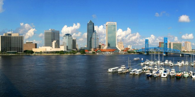
The St. Johns River is many things to many people, but not everyone has the opportunity to enjoy it as much as they would like. And while this has been known for some time, very little has been done to increase public access to the river. Now you have a chance to help change that (more on this in a moment).
Regarding the lack of action, here’s an example: The Jacksonville Community Council Inc. released a study in 2005 called “River Dance” (ow.ly/YN3PD). One of the main findings was that river access was a major issue for residents.
Fast-forward several years and the Jacksonville Waterways Commission, a voluntary citizen advisory group to the City Council that provides input on river- and water-related issues, was examining several land-use proposals that would affect the river.
The original focus of the Waterways Commission was more on manatee protection, river taxis and boat ramps, but its scope has expanded in recent years to look at anything that affects the river.
Thus any land-use change proposal comes to the Waterways Commission for review and comment. At one meeting, the commission asked if the city had any kind of master plan for its waterfront. The answer was “No.”
Part of the commission’s concern was the loss of what was termed “working waterfronts” to residential development. Commercial marinas with docks and boat repair facilities were being replaced around the city with condominiums. So the concern was that without some thoughtful consideration, we might soon not have places to dock or repair boats.
In addition to considering new facilities, the commission has also spent a lot of time considering the condition of the docks, boat ramps and marinas the city owns and manages. Questions arose about the how and when of their repair and maintenance.
That series of meetings led to a proposal for a Maritime Management Plan funded by the Florida Inland Navigation District and the city.
The Northeast Florida Regional Council, Jacksonville University and the University of North Florida are developing that report and blueprint for the future, and we need your input.
The team is gathering information about all the water-related facilities in Duval County, along with the needs and desires of the community.
Hopefully we will have a document to guide the city as it maintains facilities and plans for unmet needs.
We want to emphasize the important role that water access plays in our economy and our quality of life. Now we need your help to change the way we view and use the river. We hope you will participate.
Please visit www.jaxboatplan.com to complete the survey. The results of the survey, along with residents’ input at a series of community meetings, will help guide us as we plan for the future.
The Regional Council is managing the process while JU works on the survey and looks at the environmental impact of developing land adjacent to the river. UNF is evaluating the condition of all the city’s water-related facilities such as boat ramps and docks. This will be a comprehensive look at the entire waterfront.
Ask River Life
How much waterfront is there in Duval County?
Turns out that is a somewhat difficult question to answer. Duval County has an extensive system of marshes, creeks and wetlands that make such measurements problematic. Even the size of the county depends on who you ask. Published reports list Duval as both 840 square miles and 881 square miles. It is hard to measure because of the constant changing tides with erosion and deposition happening with every tidal cycle and storm. There appear to be approximately 1,100 miles of shoreline in Duval County, with somewhere between 75 and 110 square miles of open water. And it changes daily.
River Life runs the last Friday of each month in The Florida Times-Union. E-mail A. Quinton White, executive director of Jacksonville University’s Marine Science Research Institute, with questions about our waterways at qwhite@ju.edu. For more on the MSRI, visit ju.edu/msri.